![](https://static.wixstatic.com/media/0b0fec_306c66761ae140088d454f4b50237cbe~mv2.png/v1/fill/w_148,h_120,al_c,q_85,usm_0.66_1.00_0.01,enc_avif,quality_auto/0b0fec_306c66761ae140088d454f4b50237cbe~mv2.png)
![](https://static.wixstatic.com/media/11062b_f4324d20318b4007b1bb182fc0f6e9aef000.jpg/v1/fill/w_612,h_344,al_c,q_80,usm_0.66_1.00_0.01,enc_avif,quality_auto/11062b_f4324d20318b4007b1bb182fc0f6e9aef000.jpg)
The tourist route
History of 1000 years
ago
The better you know history, the further you can look into the future ...
You are entering the land of great nations and tribes. Here the great amber path began, which reached Constantinople. The Vikings came here for amber and wealth, and found shelter and the meaning of life. You are entering the Land of the Prusians.
Traveler, you will have to go through 12 places and find out the secret of a traveler like you - a Viking from the far north, who sailed on his drakkar for amber, but found ...
He visited the places where he left 12 marks, having found which, you will find out where and how his journey ended.
Find on the map Zelenogradsk (Krantskrug), Kaliningrad (Konigsberg) Klaipeda (Memel)
1
Sambia
A Viking landed on the Curonian Spit. This was in the 8th century. At that time the Curonian Spit was inhabited by the Curonian ...
![sambia2.JPG](https://static.wixstatic.com/media/0b0fec_963fe9ded9f74a06af24e5693fb39fcf~mv2.jpg/v1/fill/w_425,h_290,al_c,q_80,usm_0.66_1.00_0.01,enc_avif,quality_auto/sambia2_JPG.jpg)
![internet.png](https://static.wixstatic.com/media/263e90_20c49251b2224165bb0937c539fcad00~mv2.png/v1/fill/w_43,h_40,al_c,q_85,usm_0.66_1.00_0.01,enc_avif,quality_auto/internet.png)
![telephone.png](https://static.wixstatic.com/media/263e90_3a6f866f20714d9b946217e37e5c593a~mv2.png/v1/fill/w_43,h_40,al_c,q_85,usm_0.66_1.00_0.01,enc_avif,quality_auto/telephone.png)
![i-net.png](https://static.wixstatic.com/media/263e90_89063c31e5924fb3a775703c01b3c487~mv2.png/v1/fill/w_40,h_40,al_c,q_85,usm_0.66_1.00_0.01,enc_avif,quality_auto/i-net.png)
National Park Curonian Spit, 14.7 km, Lesnoy, Russia
2
Müller height
The highest point of the largest dune near the village of Rybachy is the Müller height. Located on the picturesque Swamp Dune, which was previously romantically called Bruchberg, this point on the map of the Curonian Spit is invariably popular with tourists. I must say, very well-deserved popularity: a comfortable path with fascinating information signs, century-old spruces and fragrant thickets leads to the height, and at the end of the path it gives travelers a dizzying panorama overlooking the beautiful Baltic and the Curonian Lagoon.
![Дюна_Эфа_с_высоты.jpg](https://static.wixstatic.com/media/0b0fec_cb12cdcecfc24a7b83bc0337a9a13452~mv2.jpg/v1/fill/w_432,h_288,al_c,q_80,usm_0.66_1.00_0.01,enc_avif,quality_auto/%D0%94%D1%8E%D0%BD%D0%B0_%D0%AD%D1%84%D0%B0_%D1%81_%D0%B2%D1%8B%D1%81%D0%BE%D1%82%D1%8B.jpg)
![internet.png](https://static.wixstatic.com/media/263e90_20c49251b2224165bb0937c539fcad00~mv2.png/v1/fill/w_43,h_40,al_c,q_85,usm_0.66_1.00_0.01,enc_avif,quality_auto/internet.png)
![telephone.png](https://static.wixstatic.com/media/263e90_3a6f866f20714d9b946217e37e5c593a~mv2.png/v1/fill/w_43,h_40,al_c,q_85,usm_0.66_1.00_0.01,enc_avif,quality_auto/telephone.png)
![i-net.png](https://static.wixstatic.com/media/263e90_89063c31e5924fb3a775703c01b3c487~mv2.png/v1/fill/w_40,h_40,al_c,q_85,usm_0.66_1.00_0.01,enc_avif,quality_auto/i-net.png)
National Park Curonian Spit, 14.7 km, Lesnoy, Russia
![museum1.JPG](https://static.wixstatic.com/media/0b0fec_e6d17f2206864fb1b991c32dc65ff348~mv2.jpg/v1/fill/w_413,h_310,al_c,q_80,usm_0.66_1.00_0.01,enc_avif,quality_auto/museum1_JPG.jpg)
3
Local history museum
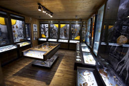
Located in the center of Zelenogradsk in an old building of the early 20th century, formerly owned by the famous lawyer Max Krell. It is an architectural monument of regional significance in the Kaliningrad region. The expositions of the museum are located on an area of 550 sq. meters, which tell about the history of the city and the region from ancient times to the present day.
![internet.png](https://static.wixstatic.com/media/263e90_20c49251b2224165bb0937c539fcad00~mv2.png/v1/fill/w_43,h_40,al_c,q_85,usm_0.66_1.00_0.01,enc_avif,quality_auto/internet.png)
![telephone.png](https://static.wixstatic.com/media/263e90_3a6f866f20714d9b946217e37e5c593a~mv2.png/v1/fill/w_43,h_40,al_c,q_85,usm_0.66_1.00_0.01,enc_avif,quality_auto/telephone.png)
+7 (40150)3-27-90
![i-net.png](https://static.wixstatic.com/media/263e90_89063c31e5924fb3a775703c01b3c487~mv2.png/v1/fill/w_40,h_40,al_c,q_85,usm_0.66_1.00_0.01,enc_avif,quality_auto/i-net.png)
st. Lenina, 6, Zelenogradsk 238530 Russia
4
Kranzburg (Zelenogradsk)
10th century. A small fishing village on the seashore suddenly appears on the map of the Amber Road and quickly becomes a checkpoint for all traders wishing to pass through the Curonian Spit. Buried treasures of the Vikings and a good location lead to the rumor about the settlement, it grows and turns into a prosperous city.
![Курортный проспект 2.jpg](https://static.wixstatic.com/media/0b0fec_3c857472f7c2459e9989d59ae3b62d6e~mv2.jpg/v1/fill/w_435,h_290,al_c,q_80,usm_0.66_1.00_0.01,enc_avif,quality_auto/%D0%9A%D1%83%D1%80%D0%BE%D1%80%D1%82%D0%BD%D1%8B%D0%B9%20%D0%BF%D1%80%D0%BE%D1%81%D0%BF%D0%B5%D0%BA%D1%82%202.jpg)
![i-net.png](https://static.wixstatic.com/media/263e90_89063c31e5924fb3a775703c01b3c487~mv2.png/v1/fill/w_40,h_40,al_c,q_85,usm_0.66_1.00_0.01,enc_avif,quality_auto/i-net.png)
Kurortny Avenue, Zelenogradsk 238530 Russia
Viking village Kaup
5
The Viking Village is a reconstruction of an early medieval settlement based on the archeology of Prussian and Scandinavian settlements and forts. Circular settlements from 25 to 100 meters in diameter are characteristic of our region in the first millennium of our era. The mound is surrounded by a moat and a rampart, the entrance group is represented by a gate tower and a fragment of a stockade.
![1kaup2.jpg](https://static.wixstatic.com/media/0b0fec_9c996ae98a70430c8afc8c376191290b~mv2.jpg/v1/fill/w_340,h_340,al_c,q_80,usm_0.66_1.00_0.01,enc_avif,quality_auto/1kaup2.jpg)
![internet.png](https://static.wixstatic.com/media/263e90_20c49251b2224165bb0937c539fcad00~mv2.png/v1/fill/w_43,h_40,al_c,q_85,usm_0.66_1.00_0.01,enc_avif,quality_auto/internet.png)
![telephone.png](https://static.wixstatic.com/media/263e90_3a6f866f20714d9b946217e37e5c593a~mv2.png/v1/fill/w_43,h_40,al_c,q_85,usm_0.66_1.00_0.01,enc_avif,quality_auto/telephone.png)
+7 9062 379926
![i-net.png](https://static.wixstatic.com/media/263e90_89063c31e5924fb3a775703c01b3c487~mv2.png/v1/fill/w_40,h_40,al_c,q_85,usm_0.66_1.00_0.01,enc_avif,quality_auto/i-net.png)
Viking village Kaup, Zelenogradsk town district, Kaliningrad region, 238000 Russia
6
Mountain of witches in Juodkrantė
Mountain of Witches - Ragana Kalnas. This amazing place with many carved wooden sculptures depicting heroes of folk legends is located behind the fishing village of Juodkrante on the Curonian Spit, 19 kilometers from Klaipeda. Fairy-tale heroes settled on one of the most beautiful dunes with a height of 42 meters. The slopes of the dune have long been overgrown with centuries-old pines, and a winding shady path leads to the top. To the east of the dune, the waters of the Curonian Lagoon gleam - Kursiu maryu in Lithuanian, and to the west from the top you can see the waves of the Baltic Sea.
The mountain is considered a sacred place among the Curonian and Samba tribes .
![Гора ведьм1.jpg](https://static.wixstatic.com/media/0b0fec_f63f66938d40467c9aecfaca59f88243~mv2.jpg/v1/fill/w_433,h_287,al_c,lg_1,q_80,enc_avif,quality_auto/%D0%93%D0%BE%D1%80%D0%B0%20%D0%B2%D0%B5%D0%B4%D1%8C%D0%BC1.jpg)
![internet.png](https://static.wixstatic.com/media/263e90_20c49251b2224165bb0937c539fcad00~mv2.png/v1/fill/w_43,h_40,al_c,q_85,usm_0.66_1.00_0.01,enc_avif,quality_auto/internet.png)
![i-net.png](https://static.wixstatic.com/media/263e90_89063c31e5924fb3a775703c01b3c487~mv2.png/v1/fill/w_40,h_40,al_c,q_85,usm_0.66_1.00_0.01,enc_avif,quality_auto/i-net.png)
7
Amber Gallery-Museum
![Янтарная галерея.jpg](https://static.wixstatic.com/media/0b0fec_457b4b857fad4f0eb35b319bb69d7529~mv2.jpg/v1/fill/w_385,h_256,al_c,lg_1,q_80,enc_avif,quality_auto/%D0%AF%D0%BD%D1%82%D0%B0%D1%80%D0%BD%D0%B0%D1%8F%20%D0%B3%D0%B0%D0%BB%D0%B5%D1%80%D0%B5%D1%8F.jpg)
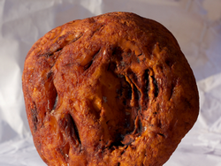
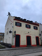
The museum is located in an old fisherman's house and greets visitors with wooden amulets from the Juodkrantė treasury. They are like museum guards. Visitors can see a collection of inclusions and amulets from the Juodkrantė treasury. All 434 amulets of the original size are found here.
The museum presents the history of Baltic amber: formation, morphology, colors and inclusions. Amber of different sizes and shapes surprises tourists. The largest piece of amber weighs 3,820 kg.
![internet.png](https://static.wixstatic.com/media/263e90_20c49251b2224165bb0937c539fcad00~mv2.png/v1/fill/w_43,h_40,al_c,q_85,usm_0.66_1.00_0.01,enc_avif,quality_auto/internet.png)
![telephone.png](https://static.wixstatic.com/media/263e90_3a6f866f20714d9b946217e37e5c593a~mv2.png/v1/fill/w_43,h_40,al_c,q_85,usm_0.66_1.00_0.01,enc_avif,quality_auto/telephone.png)
![i-net.png](https://static.wixstatic.com/media/263e90_89063c31e5924fb3a775703c01b3c487~mv2.png/v1/fill/w_40,h_40,al_c,q_85,usm_0.66_1.00_0.01,enc_avif,quality_auto/i-net.png)
8
Museum of the Memel Fortress in Klaipeda
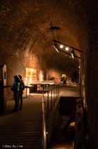
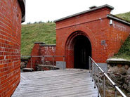
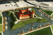
Memel Castle, the first mention of which dates back to 1252, is currently recognized as the only Lithuanian spiritual-knightly castle. Initially, it was a large-scale wooden structure, erected in the area of the mouth of the Dane River. However, already in 1253, a new, stone castle structure was erected.
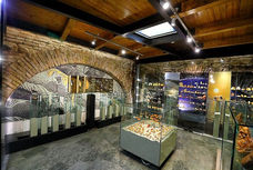
In the middle of 2002, a museum complex was organized on the territory of the castle complex. The expositions of the museum provide interesting information about the development of the Memel region and the order castle. Among the museum exhibits are numerous household items, rare weapons, jewelry, archaeological finds, national costumes of the inhabitants of Memel.
![Крепость Мемель .jpg](https://static.wixstatic.com/media/0b0fec_e67ff6425d97409fa50920d17d3ec2a2~mv2.jpg/v1/fill/w_409,h_290,al_c,q_80,usm_0.66_1.00_0.01,enc_avif,quality_auto/%D0%9A%D1%80%D0%B5%D0%BF%D0%BE%D1%81%D1%82%D1%8C%20%D0%9C%D0%B5%D0%BC%D0%B5%D0%BB%D1%8C%20.jpg)
![internet.png](https://static.wixstatic.com/media/263e90_20c49251b2224165bb0937c539fcad00~mv2.png/v1/fill/w_43,h_40,al_c,q_85,usm_0.66_1.00_0.01,enc_avif,quality_auto/internet.png)
![telephone.png](https://static.wixstatic.com/media/263e90_3a6f866f20714d9b946217e37e5c593a~mv2.png/v1/fill/w_43,h_40,al_c,q_85,usm_0.66_1.00_0.01,enc_avif,quality_auto/telephone.png)
![i-net.png](https://static.wixstatic.com/media/263e90_89063c31e5924fb3a775703c01b3c487~mv2.png/v1/fill/w_40,h_40,al_c,q_85,usm_0.66_1.00_0.01,enc_avif,quality_auto/i-net.png)
9
Monument in honor of the 1000th anniversary of Lithuania
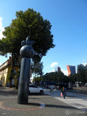
The monument in honor of the 1000th anniversary of Lithuania is located on the Dane embankment of the city of Klaipeda . The majestic monument, made of granite and bronze, depicts Prince Vitovt on horseback. The majestic figure of the great Lithuanian ruler is dressed in knightly armor and a cloak. Vitovt holds a flag in his left hand, and the reins in his right. The rider on horseback "gallops" on the symbolic huge globe, which in turn is located on a high cylindrical pedestal.
A memorandum with an appeal to descendants was placed in the foundation of the monument in a capsule. The letter also contains words of gratitude to the ancestors who created the state of Lithuania and who gave the birth of the Lithuanian language and traditions of the country.
![](https://static.wixstatic.com/media/0b0fec_6698d65eb91b448c87a2e40520fad236~mv2.jpg/v1/fill/w_427,h_320,al_c,q_80,usm_0.66_1.00_0.01,enc_avif,quality_auto/0b0fec_6698d65eb91b448c87a2e40520fad236~mv2.jpg)
![i-net.png](https://static.wixstatic.com/media/263e90_89063c31e5924fb3a775703c01b3c487~mv2.png/v1/fill/w_40,h_40,al_c,q_85,usm_0.66_1.00_0.01,enc_avif,quality_auto/i-net.png)
10
Settlement of the Curonian
Воссозданная в рамках проекта Усадьба древних Куршей.
В усадьбе возведены дом курша-рыбака, дом курша-земледельца и дом курша-вики нга. Все поселение огорожено забором с частоколом.
![12.jpg](https://static.wixstatic.com/media/0b0fec_8742d9984d8948158172d4abce163e63~mv2.jpg/v1/fill/w_432,h_324,al_c,q_80,usm_0.66_1.00_0.01,enc_avif,quality_auto/12.jpg)
![](https://static.wixstatic.com/media/0b0fec_201fe8852fff446e820cd0d0427ffcc4~mv2.jpg/v1/fill/w_435,h_340,al_c,q_80,usm_0.66_1.00_0.01,enc_avif,quality_auto/0b0fec_201fe8852fff446e820cd0d0427ffcc4~mv2.jpg)
![telephone.png](https://static.wixstatic.com/media/263e90_3a6f866f20714d9b946217e37e5c593a~mv2.png/v1/fill/w_43,h_40,al_c,q_85,usm_0.66_1.00_0.01,enc_avif,quality_auto/telephone.png)
![i-net.png](https://static.wixstatic.com/media/263e90_89063c31e5924fb3a775703c01b3c487~mv2.png/v1/fill/w_40,h_40,al_c,q_85,usm_0.66_1.00_0.01,enc_avif,quality_auto/i-net.png)